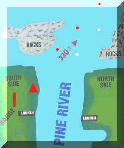
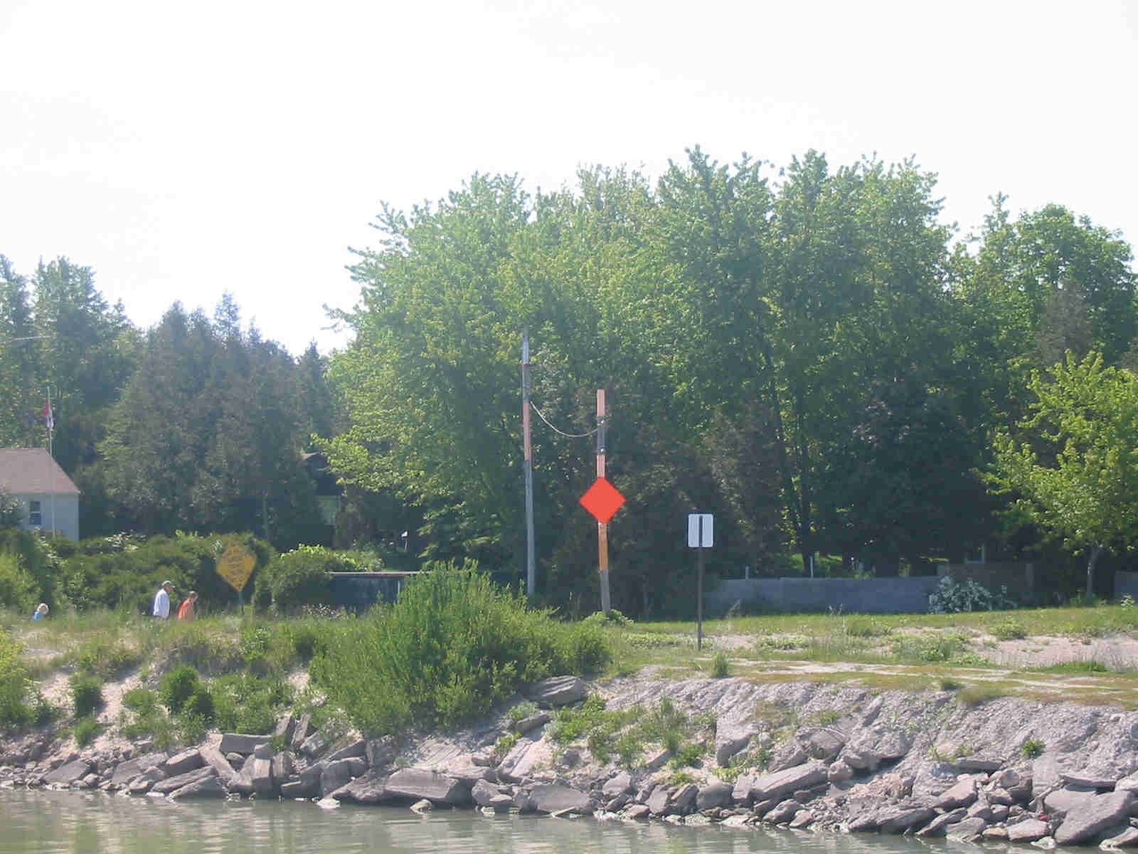
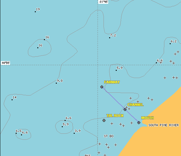
Pine River Boat Club Channel
     

Home
Executive
Application
Minutes
By Laws
Fees
Newsletters
Events
Docks
Channel
Parking Lots
Shares
Photo Gallery
History
Links
Charters
For Sale
Water Quality

Loading Channel Picture (13.3 KB)

5 Day Weather Forecast

Weather radar graphic for station WSO located near Exeter, Ontario.Radar Image

Range Markers

Line up the front marker with the rear pole to ensure your boat is positioned correctly in the river channel.

Warning to All Members

Because our river channel is very narrow, your directors have posted signs giving the right of way to the boats coming upstream (in from the lake). Boaters should exercise caution especially during strong winds. Plan to attend the spring meeting and be up-dated on the channel conditions.

Bonfires at the River Mouth

Please avoid building Bonfires at the mouth of the channel and inform others of the same as they interfere with the navigation lights for incoming boaters.

Table Rock & Channel Location

Name Latitude Longitude Latitude
(degrees)
Longitude
(degrees)
TBL ROCK N44°05.474' W81°44.936' 44.09123333 -81.74893333
MOUTH N44°05.454' W81°44.604' 44.09090000 -81.74340000
CHANNEL N44°05.578' W81°44.735' 44.09296667 -81.74558333
FAIRWAY N44°05.792' W81°44.958' 44.09653333 -81.74930000

March 08, 2023